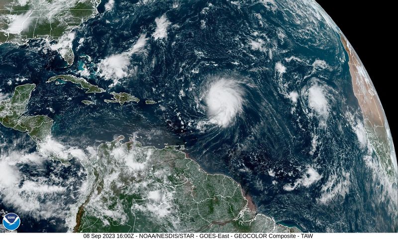
© Reuters. A composite image shows Hurricane Lee churning towards the Caribbean after intensifying into a major storm, September 8, 2023. National Oceanic and Atmospheric Administration (NOAA)/Handout REUTERS.
WASHINGTON (Reuters) -Hurricane Lee, a powerful Category 3 storm, was expected to move well north of Puerto Rico and the U.S. Virgin Islands this weekend but could cause dangerous beach conditions on the U.S. East Coast beginning on Sunday, the U.S. National Hurricane Center said on Saturday.
Lee, located about 310 miles (505 km) northeast of the northern Leeward Islands, was packing winds of 115 mph (185 kph), the forecaster said. The storm was moving west-northwest at 10 mph (17 kph) but “gradual restrengthening” was possible in the next two days, the center said.
The forecaster said it was too soon to know what level of impacts, if any, Lee might have along the U.S. East Coast, Atlantic Canada, or Bermuda late next week, especially as it is expected to slow down over the southwestern Atlantic.
“Dangerous surf and rip currents are expected to begin along most of the U.S. East Coast Sunday and Monday and worsen through the week,” the forecaster said.
Lee had intensified into a dangerous Category 5 storm earlier in the week, the highest step on the Saffir-Simpson wind scale, before downgrading into a Category 3 hurricane.
Category 5 storms can cause catastrophic damage and destroy a high percentage of framed homes, according to the National Weather Service. They also take down powerlines and trees, and can cause weeks-long electrical outages and make areas they hit uninhabitable for weeks if not longer.
“Fluctuations in intensity are likely over the next few days, however Lee is expected to remain a powerful hurricane through early next week,” it said.
An avoidance of Puerto Rico would be good news for the U.S. territory which has seen its electricity infrastructure leveled by recent storms with some mountain communities losing power for nearly a year.


